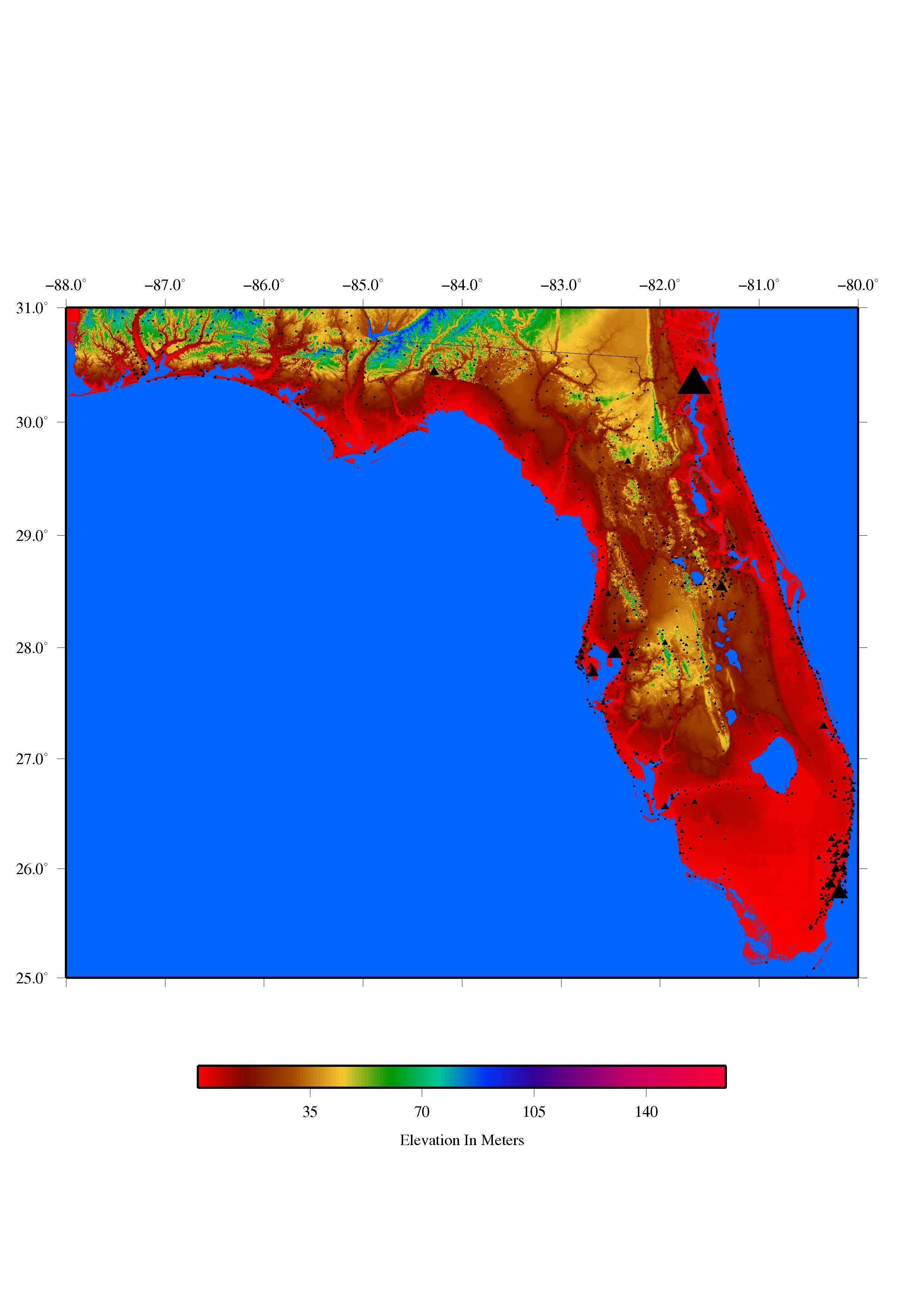
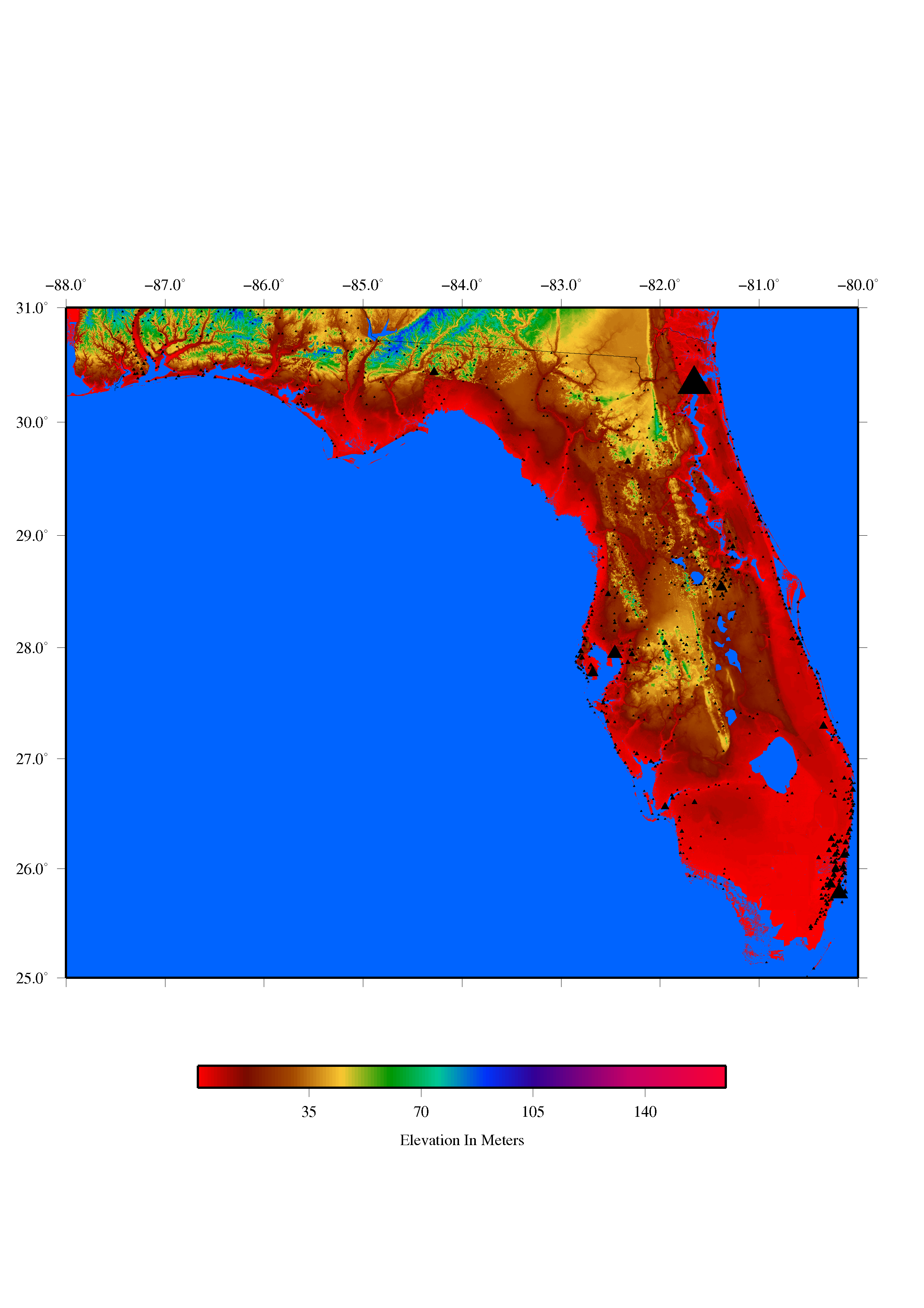
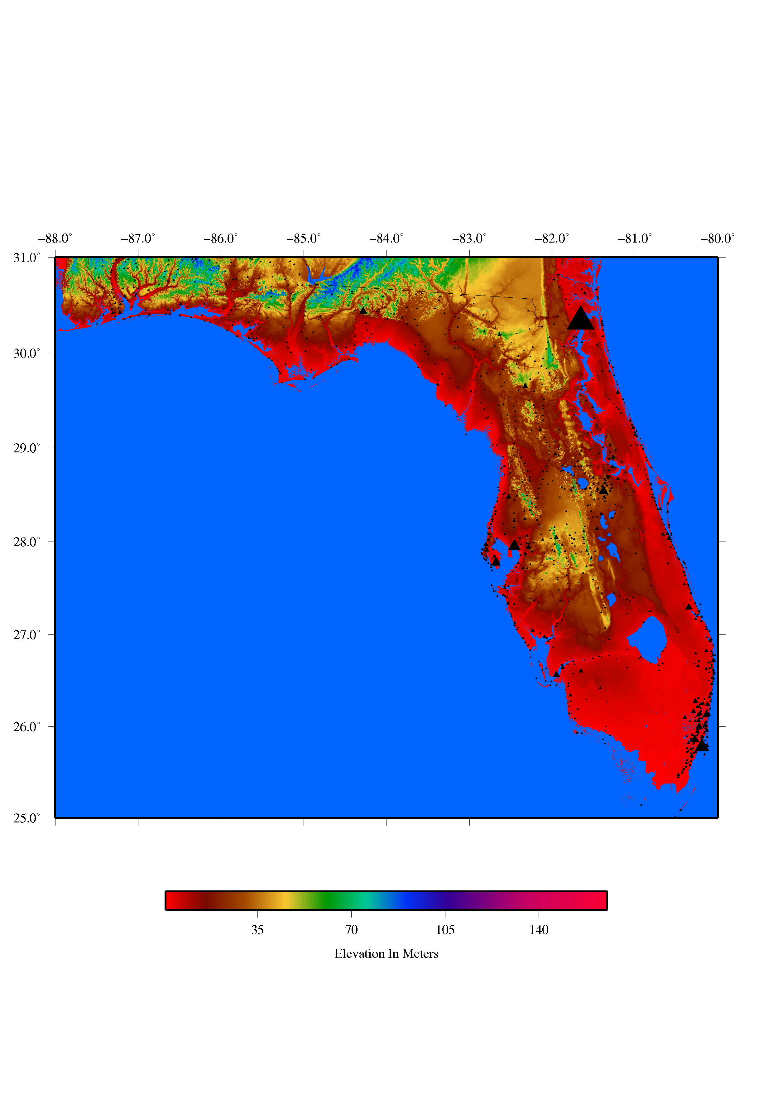
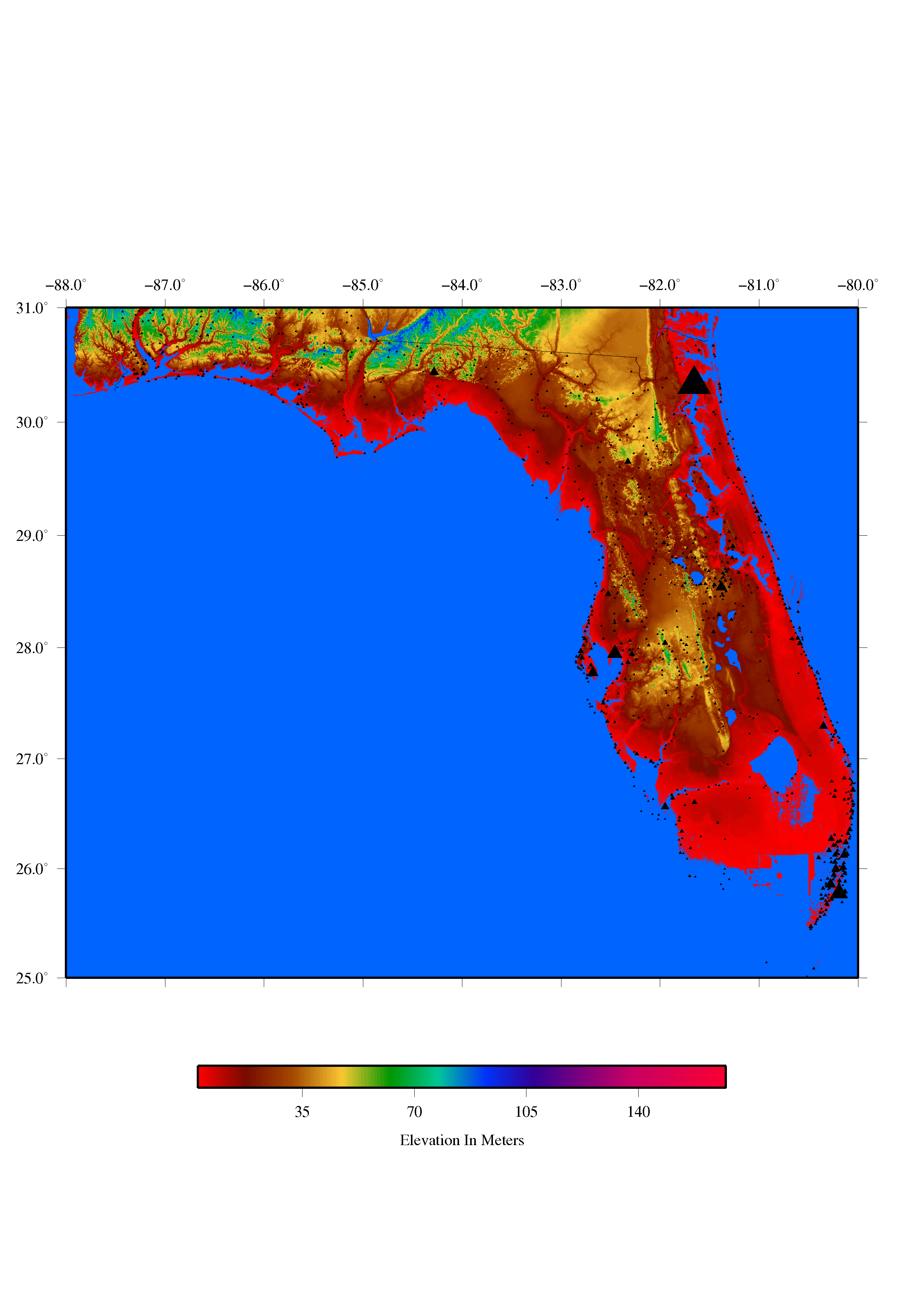
Possible Coastal Inundation For Florida
Just you wait.
Oh, wait, you don't need to wait for coastal flooding of Florida. Try going to Miami, among other places.
But just you wait for this webpage to be somewhat fancier. In the meantime, here are maps I made of Florida, with elevation data from the United States Geological Survey's one-arc-second National Elevation Dataset.1 For each successive map, I stepped the minimum value of the elevation colorscale in 0.3-meter increments from approximately the current sea level to about 2.4 meters above that. You should effectively see what Florida could look like with successive 0.3-meter increases in sea level along its coasts.
I chose a final value of 2.4 meters somewhat arbitrarily, but not unrealistically; the June 2017 Fifth-Order Draft of the U.S. Global Change Research Program Climate Science Special Report says on page 53 that "a global mean sea level rise exceeding 8 feet (2.4 m) by 2100 cannot be excluded" and that "local sea level rise is likely to be greater than the global average along the U.S. Atlantic and Gulf Coasts."2 So, no, these maps are not a guarantee that Florida won't experience more or less local sea-level rise by 2100, let alone before or after that. But we are currently experiencing some consequences of sea-level rise and we will suffer more of those consequences in the future, so I recommend considering these maps or similar ones before deciding to build your dream home in southern Florida, for example.
Incidentally, those black triangles are Florida cities and towns, scaled by population size, with population data and coordinates from "Cities and Towns of the United States" by the National Atlas of the United States.3


1. Elevation data are from the United States Geological Survey's one-arc-second National Elevation
Dataset. https://viewer.nationalmap.gov/basic/?basemap=b1&category=ned,nedsrc&title=3DEP
%20View
2. U.S. Global Change Research Program, 2017: Climate Science Special Report: A Sustained Assessment Activity of the U.S. Global Change Research Program. Fifth-Order Draft. Edited by Wuebbles, D.J., D.W. Fahey, K.A. Hibbard, D.J. Dokken, B.C. Stewart, and T.K. Maycock. U.S. Global Change Research Program, Washington, D.C., U.S.A., 669 pages. I found this on the New York Times website, at https://www.nytimes.com/interactive/2017/08/07/climate/document-Draft-of-the-Climate-Science-Special-Report.html .
3. City and town coordinates are from the "Cities and Towns of the United States" Edition 2 dataset,
March 2014, by the National Atlas of the United States, which you can find at https://catalog.data.gov/dataset/cities-and-towns-of-the-united-states-direct-download .
Also, major credit where credit is due! I made all of these maps with Generic Mapping Tools Version 4.5.15; you can find more information about GMT at http://gmt.soest.hawaii.edu/projects/gmt .
...Can I leave this webpage now?
Yeah, yeah, okay. Click the nearly-invisible-against-this-background link below.